Topographic Maps
Profiling, Measuring, and Computing Gradient
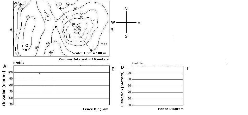
Base your answers to the following questions on the diagram above and your knowledge of topographic maps. You will need a metric ruler and a calculator to complete this exercise.
1. Prepare a topographic profile along line A-B.
2.Prepare a topographic profile along line D-F.
3.Determine the elevation at point C.
4.Determine the elevation at point E.
5.How can we describe the feature at Point G?
6.Determine the actual distance between points C and E.
7.Determine the actual distance between points D and E.
8.Compute the gradient between points C and E